


063OAK1 - OAK 1 Voting District, Clayton County, Georgia
About
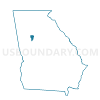
Outline

Summary
| Unique Area Identifier | 560712 |
| Name | 063OAK1 - OAK 1 Voting District |
| County | Clayton County |
| State | Georgia |
| Area (square miles) | 6.90 |
| Land Area (square miles) | 6.89 |
| Water Area (square miles) | 0.01 |
| % of Land Area | 99.93 |
| % of Water Area | 0.07 |
| Latitude of the Internal Point | 33.63845210 |
| Longtitude of the Internal Point | -84.42826000 |
Maps


Graphs
Select a template below for downloading or customizing gragh for 063OAK1 - OAK 1 Voting District, Clayton County, Georgia


Neighbors
Neighoring Voting District (by Name) Neighboring Voting District on the Map
- 063FP1 - FOREST PARK 1 Voting District, Clayton County, GA
- 063FP3 - FOREST PARK 3 Voting District, Clayton County, GA
- 063OAK2 - OAK 2 Voting District, Clayton County, GA
- 063OAK4 - OAK 4 Voting District, Clayton County, GA
- 063RD01 - RIVERDALE 1 Voting District, Clayton County, GA
- 063RD11 - RIVERDALE 11 Voting District, Clayton County, GA
- 12112E2 - 12E2 Voting District, Fulton County, GA
- 12112M - 12M Voting District, Fulton County, GA
- 121CP02A - CP02A Voting District, Fulton County, GA
- 121CP04 - CP04 Voting District, Fulton County, GA
- 121CP06 - CP06 Voting District, Fulton County, GA
- 121CP07B - CP07B Voting District, Fulton County, GA
- 121CP08A - CP08A Voting District, Fulton County, GA
- 121CP08C - CP08C Voting District, Fulton County, GA
- 121HP01 - HP01 Voting District, Fulton County, GA
- 121SC27 - SC27 Voting District, Fulton County, GA
Top 10 Neighboring County Subdivision (by Population) Neighboring County Subdivision on the Map
- Atlanta CCD, Fulton County, GA (531,648)
- Forest Park-Morrow CCD, Clayton County, GA (91,196)
- Fairburn-Union City CCD, Fulton County, GA (79,188)
- Riverdale CCD, Clayton County, GA (75,759)
- College Park CCD, Fulton County, GA (12,309)
- College Park CCD, Clayton County, GA (9,879)
Top 10 Neighboring Place (by Population) Neighboring Place on the Map
Top 10 Neighboring Unified School District (by Population) Neighboring Unified School District on the Map
- Fulton County School District, GA (528,870)
- Atlanta City School District, GA (420,003)
- Clayton County School District, GA (259,424)
Top 10 Neighboring State Legislative District Lower Chamber (by Population) Neighboring State Legislative District Lower Chamber on the Map
- State House District 66, GA (61,283)
- State House District 74, GA (48,881)
- State House District 60, GA (39,431)
- State House District 62, GA (37,690)
Top 10 Neighboring State Legislative District Upper Chamber (by Population) Neighboring State Legislative District Upper Chamber on the Map
- State Senate District 35, GA (214,483)
- State Senate District 44, GA (170,216)
- State Senate District 34, GA (160,881)
- State Senate District 36, GA (145,158)
Top 10 Neighboring 111th Congressional District (by Population) Neighboring 111th Congressional District on the Map
Top 10 Neighboring Census Tract (by Population) Neighboring Census Tract on the Map
- Census Tract 105.07, Fulton County, GA (7,974)
- Census Tract 108, Fulton County, GA (6,372)
- Census Tract 403.08, Clayton County, GA (4,520)
- Census Tract 405.09, Clayton County, GA (4,263)
- Census Tract 105.08, Fulton County, GA (3,757)
- Census Tract 402.04, Clayton County, GA (3,745)
- Census Tract 402.03, Clayton County, GA (3,633)
- Census Tract 106.03, Fulton County, GA (3,507)
- Census Tract 106.04, Fulton County, GA (3,482)
- Census Tract 402.02, Clayton County, GA (2,501)